

- Patrimoine
 Livres anciens
  Images
- Titres
- + de titres
- Thèmes
- + de thèmes
- Livres
- + de livres
- Pays
- + de pays
- Provenance
- + de provenance
 Fonds Jean Bernabé
 Fonds René Maran
 Esclaves de Guyane
 Esclavage en Martinique
 Catalogue collectif des périodiques
- Recherche
 Audio-Vidéo
 Études et recherches
 Etudes Caribéennes
 Tramil
- Thématiques
 Or
Or Esclavage et résistances
Nombre de mots: Lucie: 178, Sainte: 2186
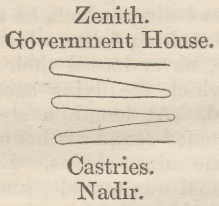 Zenith. Government House. Castries Nadir. Année de publication : |
 Description des côtes de la Goyane ou Guyane Auteur(s) : Biteow |
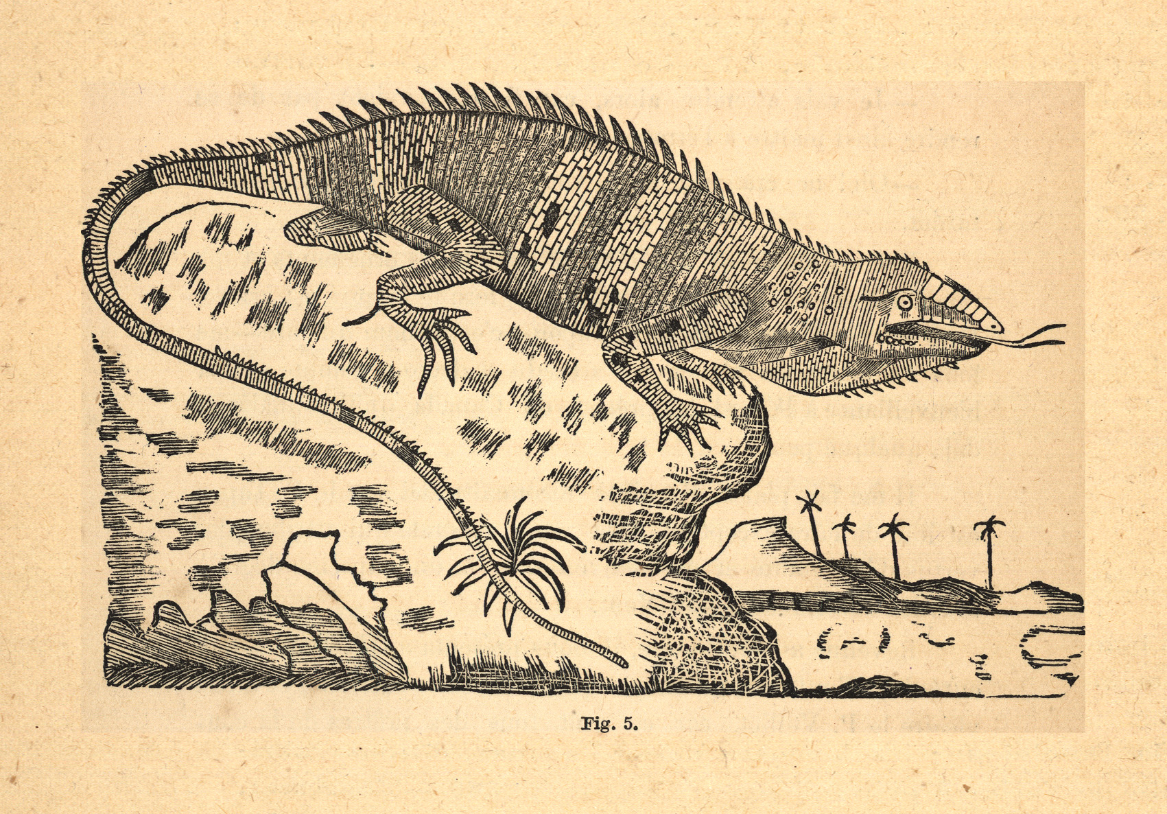 Iguana delicatissima |
 Le Fer de lance, Trigonocephalus lanceolatus |
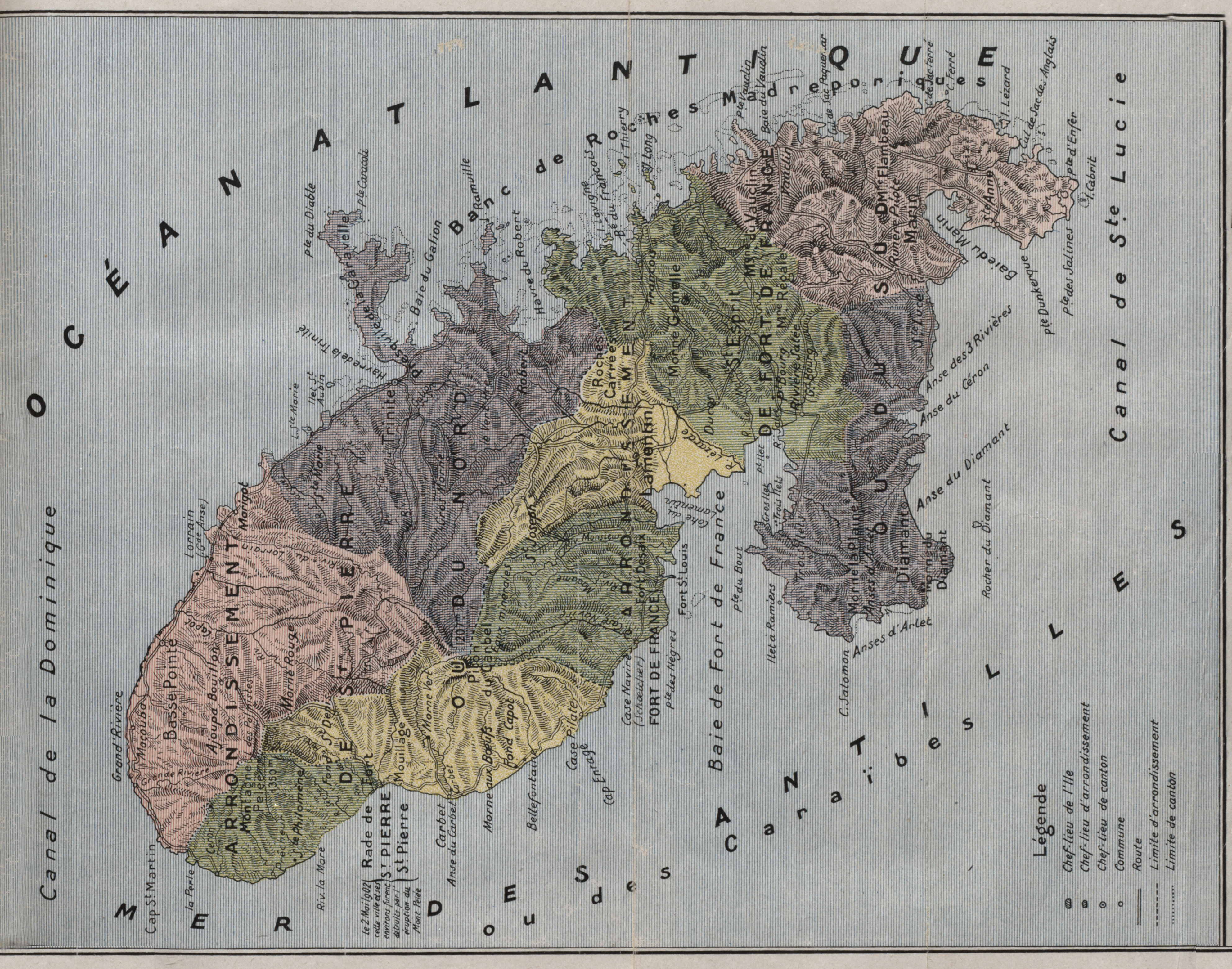 " Carte de la Martinique " Année de publication : |
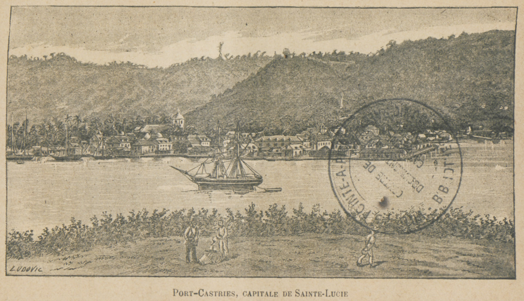 Port-Castries, Capitale de Sainte-Lucie Auteur(s) : Jeunesse, Auguste (18..-18..) Année de publication : |
 [866_Wallace Jefferson] Année de publication : |
 [867_Régis Paul] Année de publication : |
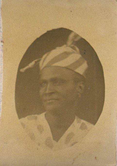 [868_Granger Anastasie] Année de publication : |
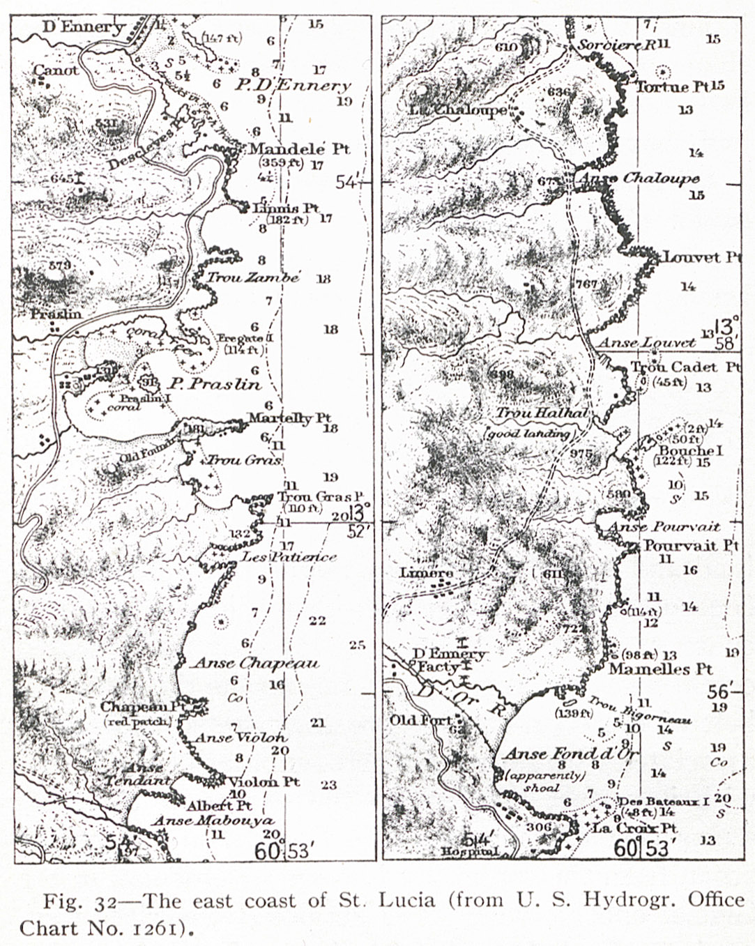 Fig. 32 The east coast of St. Lucia (from U. S. Hydrogr. Office Chart No. 1261). |
| Fig. 36 The village of Soufrière on a delta front on the southwest coast of St. Lucia. |
| Fig. 31 The low cliffs of the mid-west coast, St. Lucia. |
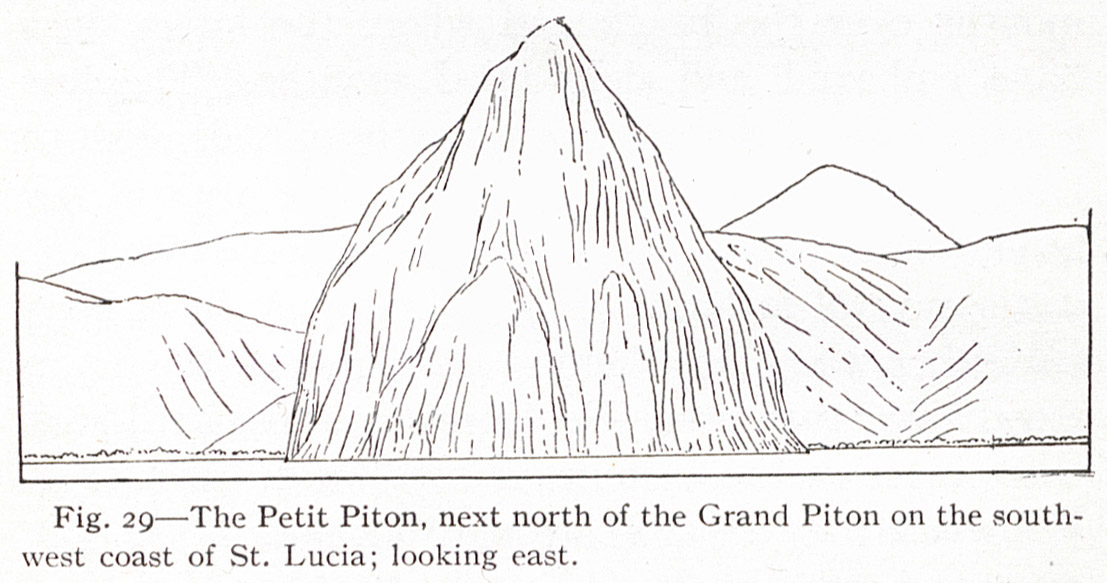 Fig. 29 The Petit Piton, next north of the Grand Piton on the southwest coast of St. Lucia; looking east. |
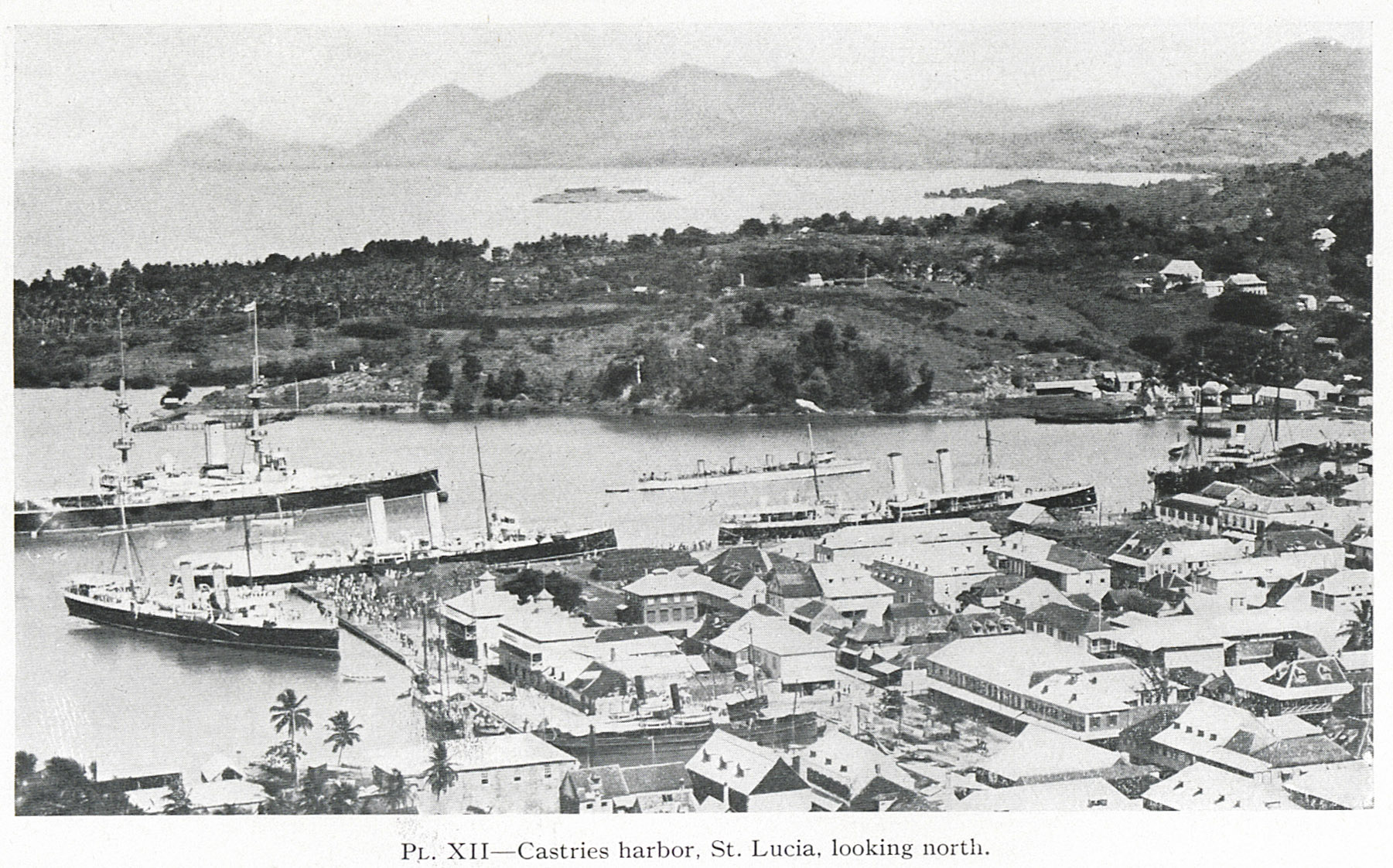 PL. XII Castries harbor, St. Lucia, looking north. |
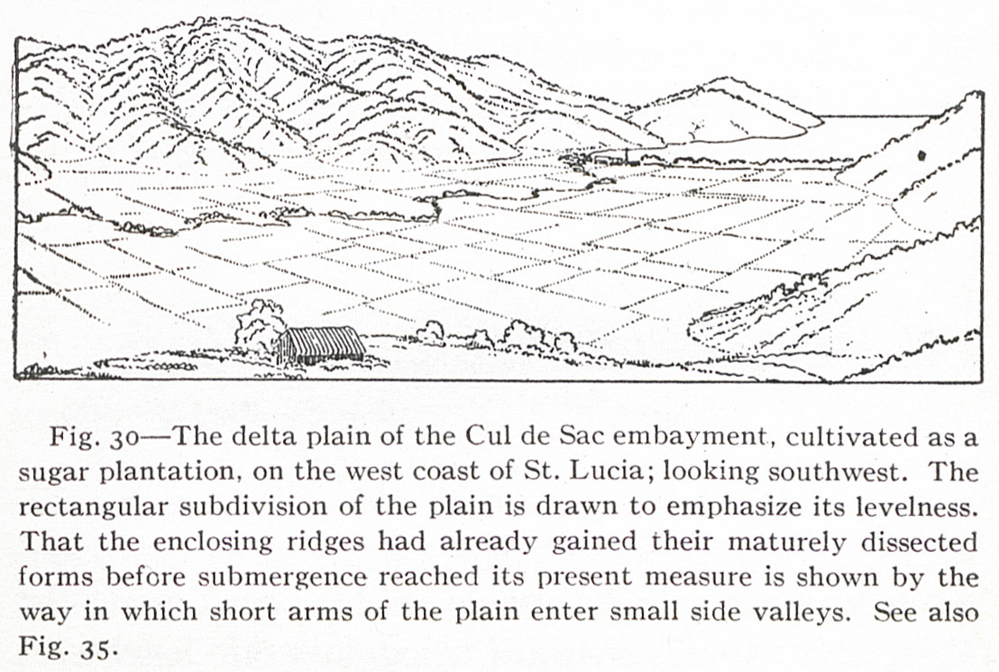
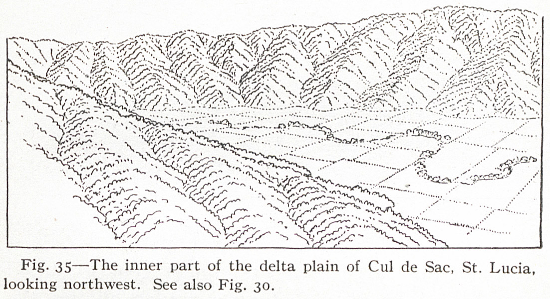 Fig. 35 The inner part of the delta plain of Cul de Sac, St. Lucia, looking northwest. See also Fig. 30. |
| Fig. 31 The low cliffs of the mid-west coast, St. Lucia. |
 Fig. 28 The Grand Piton, on the southwest coast of St. Lucia, where it is adjoined by the cliff-margined mud flow; looking northwest. The Petit Piton rises in the background. |
| Fig. 27 The mud flow of southwestern St. Lucia, by which several to the main island. |