

- Patrimoine
 Livres anciens
  Images
- Titres
- + de titres
- Thèmes
- + de thèmes
- Livres
- + de livres
- Pays
- + de pays
- Provenance
- + de provenance
 Fonds Jean Bernabé
 Fonds René Maran
 Esclaves de Guyane
 Esclavage en Martinique
 Catalogue collectif des périodiques
- Recherche
 Audio-Vidéo
 Études et recherches
 Etudes Caribéennes
 Tramil
- Thématiques
 Or
Or Esclavage et résistances
Nombre de mots: Îles: 51
 PL. XIV General view of harbor, St. Thomas, Virgin Islands. |
| Seen from Blackbeard Castle on a hill back of the town; looking south |
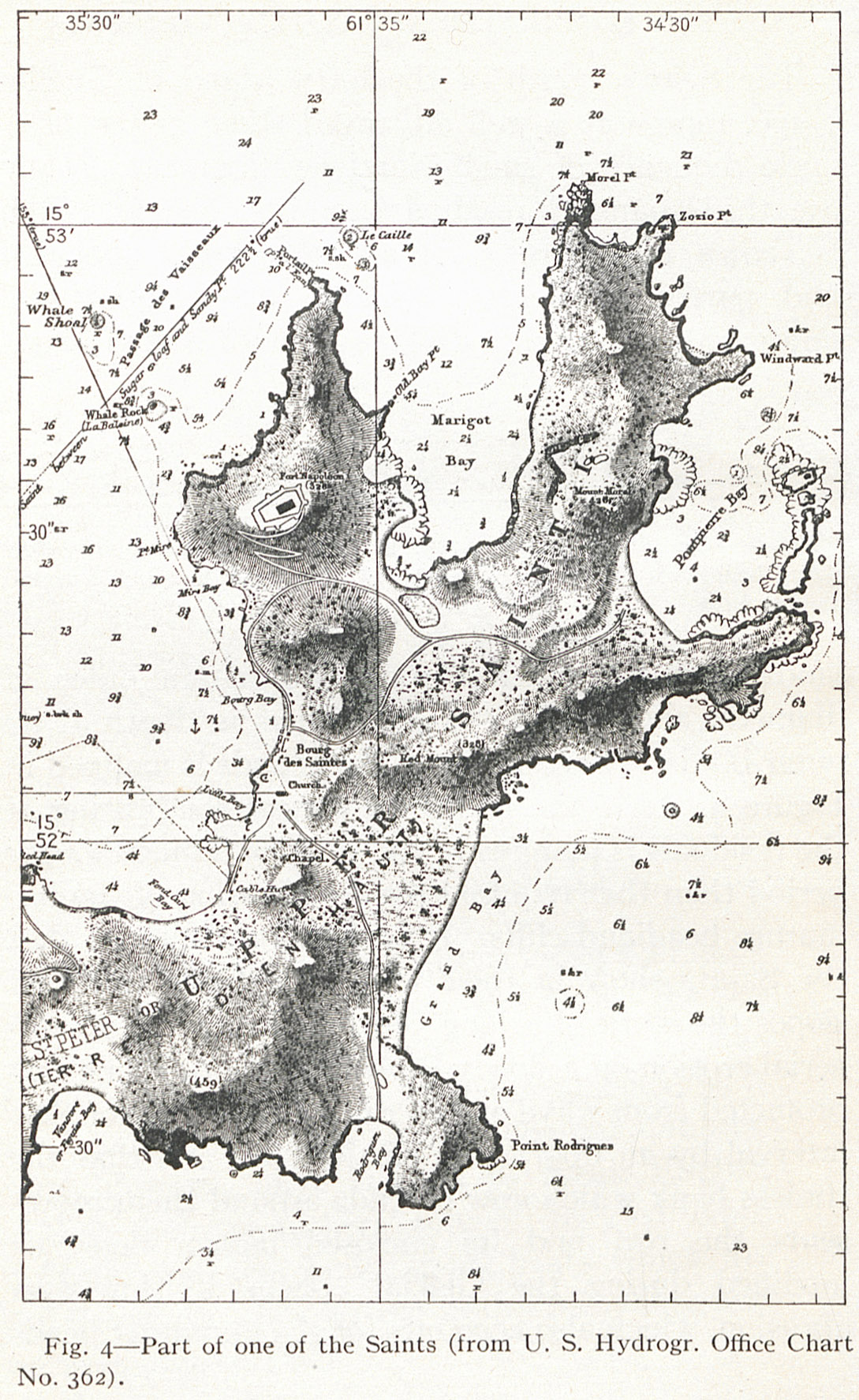 Fig. 4 Part of one of the Saints (from U. S. Hydrogr. Office Chart No. 362). |
| Eriksted, showing the absence of shore cliffs. |
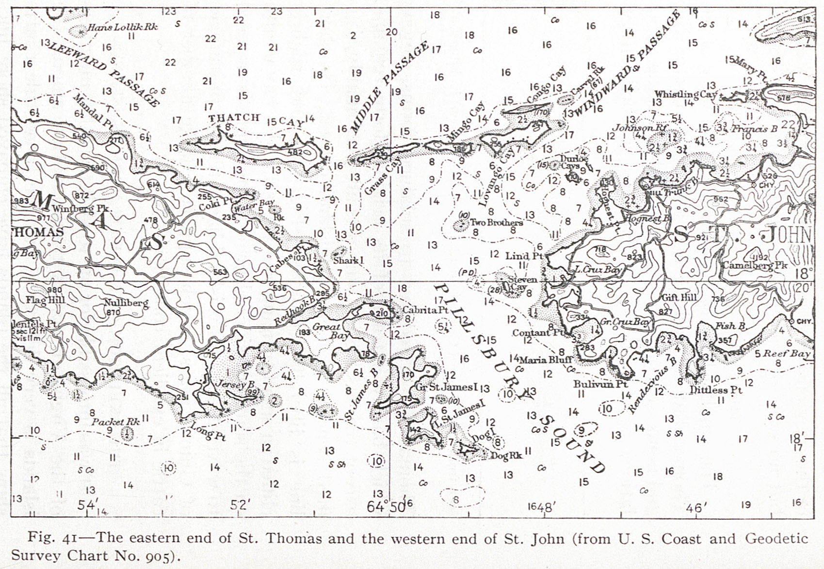 Fig. 41 The eastern end of St. Thomas and the western end of St. John (from U. S. Coast and Geodetic Survey Chart No. 905). |
| Fig- 55 A lightly cliffed headland on the north coast of St. Croix. |
| Fig. 49 Diagram of a partly submerged cliff. |
| Fig. 48 Cockroach Island, northwest of St. Thomas, looking north. |
| Of the low headland cliffs in contrast with the advanced maturity of the is seen at the bay head on the left. |
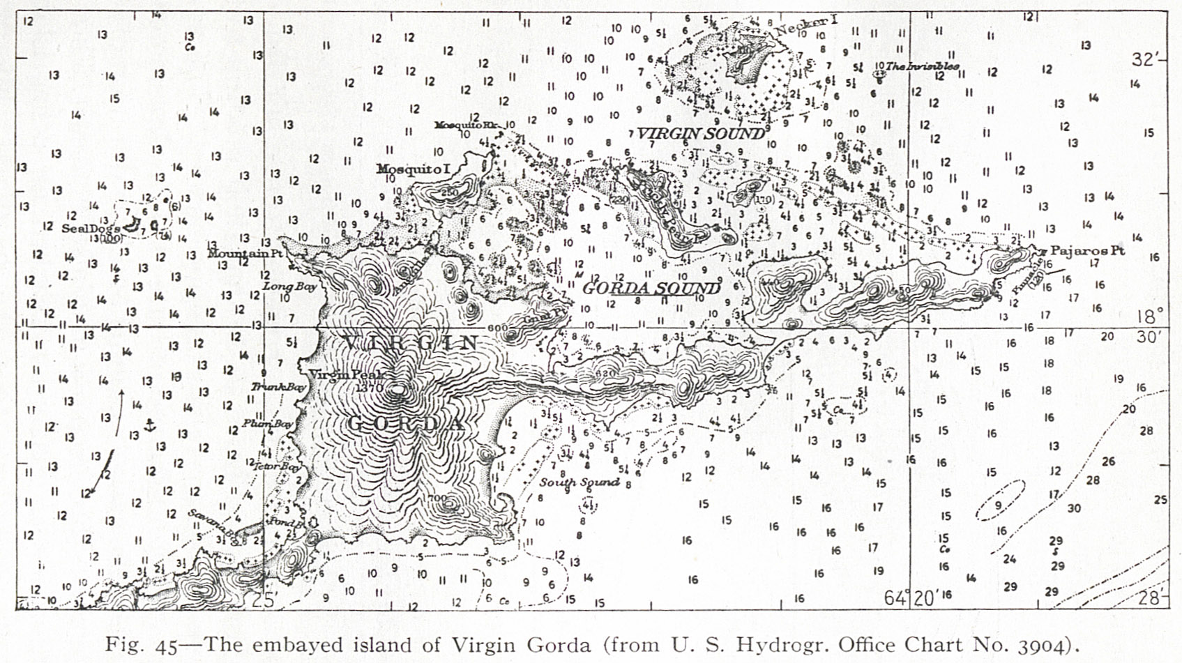 Fig. 45 The embayed island of Virgin Gorda (from U. S. Hydrogr. Office Chart No. 3904). |
| Fig. 39 Part of St. Thomas, as seen from the south. The immaturity spurs and valleys is strikingly shown. Part of the town of St. Thomas |
| Fig. 46 A cliffed island at the entrance to St. Thomas harbor, looking north. |
| Fig. 57 The non-cliffed north coast of St. Croix at Christiansted. |
| Fig. 47 Cockroach Island, northwest of St. Thomas, looking east. |
| Fig. 58 The north coast of eastern St. Croix. |
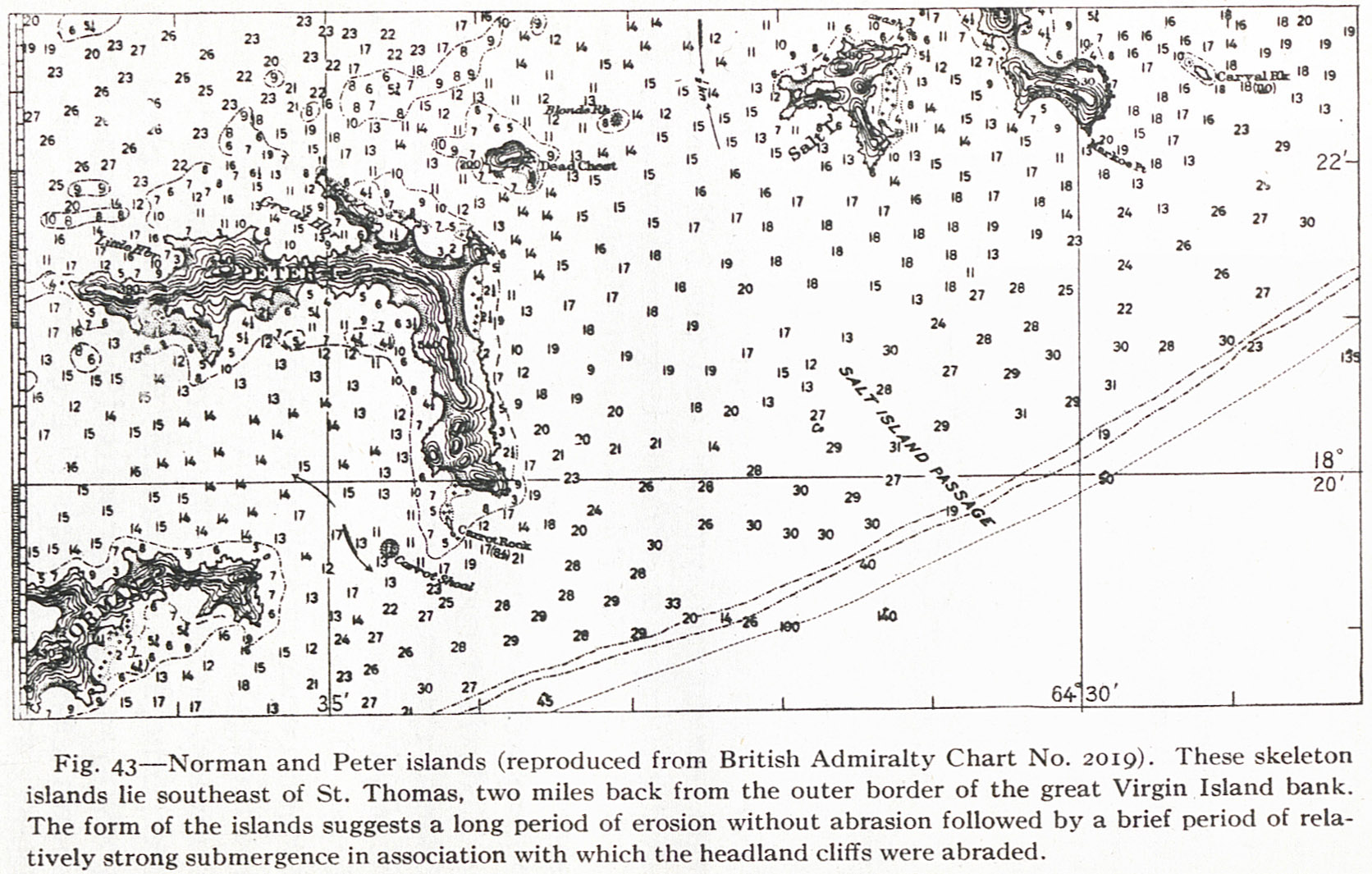
 Fig. 44 The embayed island of Tortola and the near-by islands (from U. S. Hydrogr. Office Chart No. 3904). |
| Fig. 56 The western end of St. Croix at Fred |
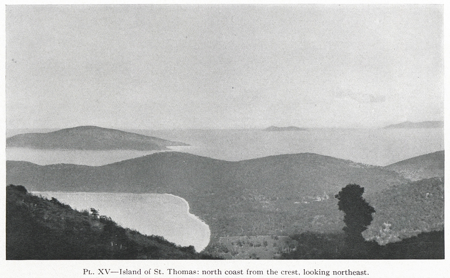 PL. XV Island of St. Thomas: north coast from the crest, looking northeast. |